Lindsay Bremner, Roberto Bottazzi, assisted by Beth Cullen and Michele Vianello

Chennai: An aerial photo of flood relief operation by Indian Coast Guard at flood affected areas of Kanchipuram District on the outskirt of Chennai. PTI Photo(PTI11_17_2015_000055B). Source: https://www.thequint.com/topic/Chennai%20Floods.
Overview
For the next three years, DS18 will participate in the research agenda of Monsoon Assemblages, a five-year research project funded by the European Research Council. Students will be working consecutively in three South Asian cities – Chennia, Delhi and Dhaka, which they will be exploring as what we have called “monsoon assemblages.” By this we mean complex, emergent urban systems operating under uncertain conditions brought about by changing monsoon climates, rapid urbanisation, rampant neoliberal development, planning policies, everyday practices etc. This confluence often not only produces floods, heat waves, out-break of disease, water shortages and power failures, it also couches such cities in disaster discourse and the monsoon as a seasonal disaster-in-waiting.
In this studio, students will take a radically different approach to the monsoon, a vast meteorological system which impacts climate across half of our planet. They will develop an understanding of its dynamic architectures. They will explore the multiple ways in which it is woven into the fabric of urban life, the multiple forms of knowledge, the rituals and the infrastructures that have been built up around it (scientific, cultural, everyday). They will develop different ways of engaging with it, representing it and giving it voice. This research will provide the basis for the development of an approach to design in which the constructed landscape functions as a synthesizer of socio-political, cultural, meteorological, hydrological and geological processes. This is applicable not only in monsoon cities, but transferable to other contexts in their future professional life.

In 2016/17, we will be working with the phenomenon of monsoon rain. Using physical and computational experiments, students will simulate it, shape surfaces with it and model its interaction with the earth. They will then map and visit Chennai, India’s fourth largest city and the capital of Tamil Nadu, in the south-east of the country. Here we will spend a week hosted by the School of Architecture and Planning at Anna University, when we will participate in field work and design workshops that directly engage with monsoon rain and the surfaces, grounds, people, animals, plants, practices and places it shapes. Our site will be a 9km transect in south Chennai from the Bay of Bengal to the Kilkattalai Lake, which incorporates the Chinna Nilgarai Kuppam (a fishing village), the Neelangarai upmarket residential neighbourhood, the Palliikanarai Marsh, Perungudi Municipal Dump and Karapa-gambal Nagar (a slum resettlement area), and crosses the the Buckingham Canal and IT Corridor (19th C and 21st C infrastructure corridors). You will undertake field work throughout this transect in order to understand, map and record elements of rain’s physical, social and political life. To do this you will use audio, mapping, participatory, photographic, sampling and video techniques. This data will form the basis of a strategic masterplan for a portion of the transect and a design brief that students will develop in the second semester.
The aim of the studio will be to develop an approach to the design of constructed landscapes as synthesizers of physical (meteorological, hydrological and geological), cultural, socio-political and technological systems and processes, relevant not only in monsoon cities, but transferable to other contexts in your future professional life.
The Monsoon

The monsoon is not a “thing”, but a dynamic planetary climatic system, or rather assemblage of many out-of-phase interconnected climatic systems driven by air pressure and temperature differentials. Our present understanding of the global climate system shows that the monsoon not only driven by different rates of heating and cooling of the Indian Ocean and the Asian plateau, producing on and off shore winds, but also by the sea saw of air mass and ocean temperature called the El Nino-Southern Oscillation (or ENSO for short) in the Pacific Ocean. It is impacted by the timing and depth of snowfall in the Himalayas and by anthropogenic factors such as aerosol particles, forest cover and land use changes. Experience of it is filtered by ritual, by the media, by technology, by economic and political systems and practices. Knowledge of it is produced by a range of knowledge systems, such as cosmology, oceanography, meteorology, hydrology, agriculture and everyday life. It is experienced as black skies, as torrential rain, as drought, as humidity, as winds, as enormous waves, as flooded streets, but also as new life, as ground water and as food. It is this climatic phenomenon that we will engage and design with while participating in the Monsoon Assemblages project.

Further Reading:
Davis, M. (2002). Late Victorian Holocausts. London: Verso; Frater, A. (2005). Chasing the Monsoon. London: Picador
Further Viewing:
BBC 2. Wonders of the Monsoon.
Chennai

Chennai, 2016. Source: http://www.mapsofworld.com/india/tamilnadu/chennai-map.html
Post-colonial India has seen massive rates of industrialization and urbanization. After the introduction of neoliberal economic policies in the 1990’s, global urban planning formulae (special economic zones, industrial estates, gated residential compounds etc.) and world city imaginaries have been adopted to attract foreign investment, particularly in the IT industry, and speculative building practices have transformed peripheral urban landscapes and impacted monsoonal ecologies. Chennai is no exception. Its colonial history dates back to 1639, when a tract of land along the beach was granted by a local leader to the British East India Company to set up a cloth manufacturing company. It was named Madras and made a Presidency in 1653. By 1687 was considered the prime city in British colonial India. By 1772, not 100 years later, Calcutta had replaced it as the capital of British India and in the 19th Century, it was bypassed by the industrial boom that transformed Calcutta and Bombay and retained a semi-rural atmosphere. This endured long after independence from Britain in 1947, when its identity was defined by regionalist Dravidian politics and it failed to establish itself as a national metropolis. However, this changed in the 1990’s after the implementation of neoliberal economic reforms. Tamil Nadu was one of the first states to adopt the national neoliberal agenda and by 2001 it was emerging as one of the prime destinations for foreign investment.

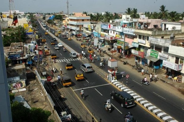
Rajiv Gandhi Salai, Chennai. Source: http://www.newindianexpress.com/cities/chennai/2013/aug/12/Residential-boom-in-IT-corridor-505946.html
One of the state’s multipronged strategies was to transform an existing road extending south from Chennai into a six-lane 18-kilometer tolled expressway that linked three new state-sponsored IT campuses. Real estate developers and IT-based firms were offered a package that included tax incentives and promises for uninterrupted electricity and water supply in order to attract investment in high-end commercial and residential properties in the area. In doing so, they , dramatically transforming the peri-urban coastal wetlands.
Chennai is located on a flat coastal plain. It depends for its water on annual monsoon rainfall feeding its surface water bodies (lakes, tanks, reservoirs and ponds) and replenishing its aquifer. What is evident from maps over its 350-year history is that, as the city has developed, its seasonal water bodies have been soft targets and been filled in or encroached upon to make way for construction or infrastructure. The IT Corridor development was no exception. Running parallel to the coastline and the Buckingham Canal (a colonial infrastructural project), it has been built on coastal sand dunes and backwaters, including the Pallikaranai Marsh, a vital conduit for rainwater into the city’s groundwater reserves and part of an excess water discharge system to the Bay of Bengal. The Chennai floods of 2015 were, in part, due to the cumulative effect of these policies and practices.

View across Pallikanarai Marsh from 200 ft Road https://tvaraj.files.wordpress.com/2014/02/palikaranai-100-feet-rd-pallikaranai-chennai-posted-by-arun-christopher-ilovchennai-blogspot-in1.jpg
Further reading:
Arabindoo,P. (2009). “Falling Apart at the Margins? Neighbourhood Transformations in Peri-Urban Chennai.” Development and Change. 40(5):879-901; Chance2Sustain. (2014). Engaging with Sustainability Issues in Metropolitan Chennai; Varrel, A. (2011). “The “IT” mantra in mega-projects in India: the case of the IT Highway in Chennai. Locating implications and contradictions for metropolitan development.” Rethinking Development in an Age of Scarcity and Uncertainty. 19-22 Sept. 2011. University of York.
Further Viewing:
Programme Overview
Semester 1 Brief 1: Hydrological Prototype
5 weeks, individual work

MAD Architects. Fish Tank. Source: ngote.files.wordpress.com/2011/05/fish3.gif and https://s-media-cache-ak0.pinimg.com/236x/7c/b5/33/7cb5336d8906a03f5cf891a4f9e78af6.jpg
This brief invites students to model rainfall and develop prototypical interfaces between sky and ground under conditions of monsoon rain. When it rains, rain percolates into the ground until the ground is saturated, then it pools, fills depressions, and then, if it can, it flows to lower ground, if not, it rises and floods. Buildings stand in the path of this sequence, usually dealing with rain by introducing pipes and drains to channel it to underground sewers and discharge it into rivers or the sea. Under monsoonal conditions, it is precisely this way of doing things that is partly responsible for floods, and their obverse, droughts, for pipes are never sized right, require maintenance, get blocked and prevent water from percolating into and replenishing aquifers.
Students are asked to develop alternative ways of doing this, by
- simulating the physical behavior of monsoon rain and developing an attitude towards it (such as absorb, channel, dam, disperse, drain, filter, harvest, retain etc.)
and
- modeling its interaction with shapes, surfaces and materials to produce a prototypical envelope that at the same time as performing in a certain way will accentuate aesthetic properties of rain (such as sound, smell, fall, colour, reflectivity etc.)
Output: digital and concrete models
Further Reading:
Jacek Krenze. (no date). Rain in Architecture and Urban Design; James Joyce. (1922). Ulysses, 1992 edition, 783-785. London: Penguin; Kristian Alexander Hyde. (2012). Phenomena: Rain.
Precedent:
Andre Bloc; Andres Jaque / Office for Political innovation. COSMO; Arboreal. Tyrrell; Ayse Erkman. Plan B; Biothing. Ghatkopar India School Façade; Carlo Scarpa: Brion Cemetery; Francois Roche. Water Flux (and others); From the Earth’s Crust; MAD Architects. Fish Tank; PITCHAfrica; Studio Mumbai. Copper House II.

Studio Mumbai. Copper House 2. Source: http://mentalspaceodyssey.tumblr.com/post/91333134355/remash-copper-house-ll-studio-mumbai-enrico ©Fotografie Enrico Cano
Brief 2: Base Mapping a Chennai transect
3 weeks, group work

Pallikaranai transect.
Students will be divided into five groups of four students each to develop base maps of the Chennai transect and its subterranean layers, using rhino and grasshopper plug-ins. These maps will serve as base maps, to be verified and added to during the field trip to Chennai.
Output: Digital maps, 5 x printed map panels and laminated, loose-leaved map books for field work.
Precedent:
Desimini, J. and Waldheim, C. (2016). Cartographic Grounds. New York: Princeton Architectural Press; Robert Pietrusco.
Brief 3: Field Trip
1 week, Group Work

Neelankarai. Sources: http://profiles.sulekhalive.com/mstore/14041316/albums/default/thumbnailfull/neelankarai.jpg
http://www.thehindu.com/multimedia/dynamic/01887/TH10_CLRI_1887303f.jpg
In early December,we will undertake a 10-day trip to Chennai, to be hosted by Anna University SAP, where we will work in groups with their students on field work and in design workshops. Representatives of key stakeholder groups from the government, academia, NGO and communities will engage with us in lectures and seminars. We will visit the Rain Centre and one of its projects. We will undertake a transect walk through the site and map and document it in various ways. In groups we will undertake closer mappings and recordings of one part of it, either to the east or west of the Pallikanarai marsh or of the marsh itself. We will likely experience monsoon rain and document how it transforms sites and urban life. In groups in quick design workshops, you will produce a strategic masterplan for your section of the transect This will form the basis of the second semester’s individual work.
Outputs: Data (audio recordings, maps, photographs, video, drone footage (?), site samples (?)and a strategic masterplan
Reading
Next City. (2013). The Informal City Reader, pp. 108-151. Philadelphia: Next City; Kumar, M., Saravanan, K. and Jayaraman, N. (2014). “Mapping the Coastal Commons.” Economic and Political Weekly XLIX(48): 46-53.
Precedent
Anuradha Mathur and Dilip Da Cunha. (2009). SOAK. Mumbai in an Estuary. Delhi: Rupa and Co; Catherine Mossbach and Philippe Rahm. (2012). Taichung Gateway Park; Paola Vigano. (2009). The Metropolis of the Twenty-First Century. The Project for a Porous City. OASE #80: 091-107; Alan Berger. Wetland Machine; Kate Orff. (2016). Toward an Urban Ecology. New York: Monacelli
Brief 4: Declaratory Drawing
Semester 1 will terminate in a single drawing in which students graphically declare your intentions for the second semester. This will include intentional towards rain, ground, site, programme and architecture for work in Semester 2. This will be handed in as part of the interim portfolio.
Output: Declaratory Drawing
Semester 2: Hydrological Urbanism
During Semester 2, students will develop the architectural, geological, hydrological and urban strategies for their site on the basis of the strategic masterplan and hydrological prototype. The goal will be to transform the site into a novel ecological system, in which the constructed landscape becomes a synthesizer of socio-political, cultural, geological, hydrological and meteorological processes.
List of further reading resources in the library (Available here (enter Lindsay Bremner studio DS18 (Academic Year 2016/17))
This studio will be partly funded by Monsoon Assemblages, a project funded by the European Research Council (ERC) under the European Union’s Horizon 2020 research and innovation programme. Grant Agreement No. 679873.
http://www.monass.org; twitter: monass_2016; instagram: monass_2016; facebook: monsoon assemblages project

